Trippin’ to Texas
Departure Date March 1, 2023
When I’m getting ready to go somewhere I plan it out, pretty much every step of the way. During the planning stage thing evolve, change back and forth but usually turn out pretty well.
The start is always the same, start at home and end at the destination. If I’m in a hurry I select the fastest route (interstates), if I have time I select the shortest route (secondary and backroads), or my favorite is going with a scenic route. For now my go to mapping program is Garmin Mapsouce but they discontinued it years ago and I’m going to need to move over to a different mapping program soon. I’m not looking forward to that since I like what I’m using.
For this trip the original plan was to leave mid to late February. I decided going south to the Columbia River, west to the coast and south along the coast would prevent me from hitting bad roads going over the mountains. I would make my to Yuma to see a friend then on to Longview, TX.
One thing led to another and things changed, a lot. I’m now working on my third revision of the routing. I had canceled the idea of the coastal route and going to Yuma in favor of going to Grand Junction, CO for an event and taking 10 days to get to Texas and doing tourist stops along the way.
As of today, cold winter weather has moved in and it looks like it will last longer than the original forecast. The tourist things I wanted to do are outside and the weather doesn’t look like it will be fun for what I was going to do.


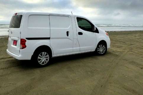
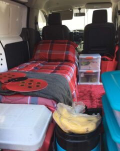
This time of year, while it’s cold, travel is done in my van and I plan to camp in it along the way. With being on a tight budget free camping is what I prefer but if I can find inexpensive camping with electricity I will spend the money to be able to run my electric heater at night.
As I travel I enjoy stopping to look for geocaches along the way because if I select them carefully they take me to interesting places. If you aren’t familiar with geocaches I explain it in: What The Heck Is Geocaching?
Revised Route
The second route, ten-day route, I had set up included, 92 geocaches, and 10 tourist sites. I was going to have a blast. All that planning will be saved for a future trip on my street motorcycle. Someday I might get it done but not this year.
To reroute I decided I could reverse the route I had created for my drive home and stop at the same places I marked for the way back. On the first night, I will stay at a motel and camp at inexpensive campsites with electricity for the next two nights.
This will only be four days with only 10 geocaches to look for and no other tourist stops. The caches help to break up the long days in the van.


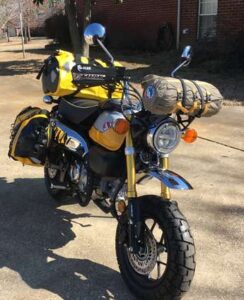
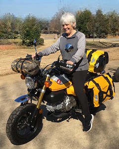
While in Texas we will be going for a weekend motorcycle ride in Louisiana and I don’t have to do any planning for it, just follow the rest of the riders. Last year I bought my Honda Monkey 125 in TX and left it there for the year. I’ll be bringing it home with me this year.
After the ride we are planning to go to Missouri to see friends for a couple of days. Then from there we will go to Branson, MO for three days, see a show, take a train ride and visit some of the tourist attractions. We’ll be taking my van and staying in motels on that trip. I made the plans for that adventure.
I made a tentative plan for my trip home then scrapped it on the second revision. Now on my third revision I’m bringing back that original plan for the trip home. On the way home I will be taking the scenic route with a visit to Big Bend National Park in TX and Death Valley in CA. I have my fingers crossed for a desert Super Bloom while I’m in Death Valley.
At this point I will have my Monkey in the back of the van so camping in it won’t work very well. I’m taking my tent and sleeping bag for camping during that part of the trip. It will be fun to be able to unload the bike in Big Bend and Death Valley and ride it around touring the parks.
All that is left now is to see how much of this I actually do.